Kobuleti
Kobuleti (ქობულეთი ) is a town in Adjara, western Georgia, situated on the eastern coast of the Black Sea. It is the seat of Kobuleti Municipality and a seaside resort, visited annually by Georgians and many former Soviet Union residents. It is especially popular with Armenian tourists. It was known as Çürüksu during Ottoman rule.
The town is situated in the south-western part of Georgia, i.e. the northern part of the Autonomous Republic of Ajara. It borders with Ozurgeti Region to the north. The Regional centre is Kobuleti City, which stretches along the Black Sea shore.
After the civil wars of 1990-1993, the once sophisticated sanatoriums remained abandoned and plundered until 2004. In the meantime Kobuleti has developed into an upscale tourist center again.
Kobuleti Region consists of one municipal, two district and seventeen village councils. There are 48 villages in the region. Representatives of 24 different nationalities live together with Georgians in the region. Kobuleti is known with its traditions, hospitality, climatic areas, mild subtropical climate, ionized maritime air, bright shining sun and warm sea. The unique sandy beach widely inclined to the sea is noted with its marvelous views beautified by sky-scraped endemic pine trees, eucalypts, bamboo, cypress grove, date and cocoa palms.
Map - Kobuleti
Map
Country - Georgia_(country)
 |
 |
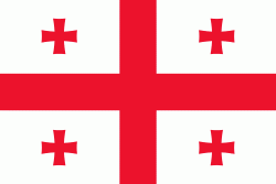
| Flag of Georgia (country) | |
During the classical era, several independent kingdoms became established in what is now Georgia, such as Colchis and Iberia. In the early 4th century, ethnic Georgians officially adopted Christianity, which contributed to the spiritual and political unification of the early Georgian states. In the Middle Ages, the unified Kingdom of Georgia emerged and reached its Golden Age during the reign of King David IV and Queen Tamar in the 12th and early 13th centuries. Thereafter, the kingdom declined and eventually disintegrated under the hegemony of various regional powers, including the Mongols, the Turks, and various dynasties of Persia. In 1783, one of the Georgian kingdoms entered into an alliance with the Russian Empire, which proceeded to annex the territory of modern Georgia in a piecemeal fashion throughout the 19th century.
Currency / Language
| ISO | Currency | Symbol | Significant figures |
|---|---|---|---|
| GEL | Georgian lari | ₾ | 2 |
| ISO | Language |
|---|---|
| HY | Armenian language |
| AZ | Azerbaijani language |
| KA | Georgian language |
| RU | Russian language |


